
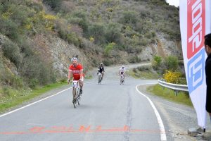
Cyprus is an ideal destination for cycling with some strong advantages including the favorable weather conditions, the soil morphology, as well as the variety of pavements in relatively short distances. the excellent network of secondary roads crossing the Cypriot countryside as well as the low traffic of vehicles on these streets are two other factors that make Cyprus a great cycling destination.
Cycling Route Kofinou – Larnaca
This route is 25 km long and connects Kofinou with Larnaca. 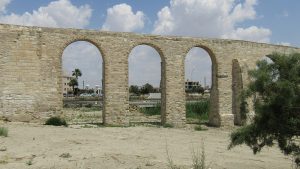 The starting point of the route is to Kofinou and it goes from the villages of Menogheia and Anglisides, you pass through the village of Alethriko, you reach the Kalo Horio junction and reach the traffic lights of the Fire Brigade in the city of Larnaca which is the finish point. It is a relatively easy route and ideal for all types of gear bikes. The route surface is made of asphalt road.
Cycling Route Nicosia – Larnaca
This route can be done from Larnaca Lefkosia or vice versa. The starting point of the route is in the round about of Tseri. It passes through the villages of Analiondas, Lithrodontas and continues eastwards towards Mathiati, Sia, Mosfiloti, Psevda and Agia Anna until the round about of the village Kalo Chorio. The end of the route is in the Fire department trafic lights and is a convenient route for any type of bicycle with speeds. The road is asphalted all the way.
Cycling Route Nicosia – Solea Valley
 It is a difficult 165 km crossing the Solea valley with its exquisite architecture and Byzantine churches with some of them being on the UNESCO World Heritage List.
The route starts from the Agios Mamas junction and ends at the same point. The route is the same as Nicosia-Asinou following an alternative way. It is a difficult path with a steady upward slope of 2% averaged and no more than 5%.
The route has a variety of surfaces and requires a mountain bike with at least 21 gears.
Cycladic Cycling Route of Nicosia
This route extends to a distance of 66 kilometers and offers the opportunity to visit Machaira Forest. The starting point is the Agios Mamas junction and ends at the round about of Tseri Street. It is a relatively difficult route, with a steep climb of about 15 km. A mountain bike with at least 21 gears is required.
Circular Cycle Route Lythrodontas
A superb route that offers the chance of a beautiful view of the mountains of Machaira. The route starts from the village square of Lythdondontas and ends at the same point. Although it is only 24 km, this route is very difficult with steep uphill and steep downhill. A 24-gear mountaineering bike is required and a suspension on the front wheel. The road is made up of a variety of surfaces, and a large part of the route is a rough road.
Ammochostos 1 – Agia Napa – Pyrgos Xylofagou Cycling Route
This route starts from the small harbor of Agia Napa and makes the round of Agia Napa, Xylofagou. This is a relatively easy route but you will need a 21 gears mountain bike. The surface consists of a paved and unpaved roads.
Cycling Route Tour of Deryneia
This is an easy route of 72 kilometers and it passes through some of the most famous beaches of Cyprus. The starting point of this route is Larnaca tourist area and the finish line is at the same point. The cyclists will need just a street bike with gears. The surface of the road is great with asphalt all the way long.
Cycling Route Kofinou – Paphos
 This 110 km route is designed for strong cyclists and runs all along the old Nicosia – Pafos – Limassol road. The route starts from Kofinou heading south and southwest to reach Limassol, passing from Choirokoitia, Moni, Amathounta and the Germasogeia River before arriving in Limassol. From Limassol, it goes westwards to Zakaki, Fassouri and Kourion until the Petra tou Romiou. It then heads northwest to reach the Pafiacon Stadium.
A route of moderate difficulty without steep uphill, although some short distances could be considered uphill. It requires a good quality street bike with at least 14 gears.
Find Cycling Route Kofinou – Paphos
Cycle Route Larnaca – Nicosia
This 60 km route is an alternative to the Larnaca – Nicosia route (or vice versa) and passes through the village of Athienou in the Messaoria peninsula.
The route starts from the roundabout at the Port of Larnaca, moves west on General Timaya Avenue to the traffic lights of Tsiakilero, where it turns right to Aradippou in the northwest direction. It passes from Aradippou, below the motorway to Paralimni, and continues in the same direction it passes outside the village of Avdellero before arriving at Athienou. From Athienou the route takes south direction on the old Nicosia – Larnaca road until the road crosses to the village of Limbia on the right, where it takes west direction. From Lympia, it passes through the villages of Dali and Nisou, under the Nicosia – Limassol motorway and through the villages of Kotsiatis and Marki. The route then turns north, passes through Tseri and ends at the roundabout of Tseri and Kokkines, just outside of Nicosia.
A path of moderate difficulty. It requires a road bike with at least 14 gears.
Cycling Route of Machairas – Pitsilia
This 25km route goes to the Machaira Forest and the Pitsilia area. From the Monastery of Machaira the route is directed westwards, passing through the small villages of Lazanias and Gouri, where it turns south to the village of Farmakas. From the village of Farmakas it moves northwest, descending to the main road of Nicosia – Palechori, with the Palechori Dam on the left. From there, the road turns left to pass from the village of Apliki, steadily climbing for 5 km until it reaches Paleochori.
A route of moderate difficulty due to various steep hills. It requires a street bike with at least 14 gears or a 21-speed mountain bike.
Cycle Route Voroklini Hill
Voroklini Hill is 207 meters above sea level and has a Chapel dedicated to Prophet Elijah. It offers exciting cycling routes and great views of the Larnaca Bay.
Since the road is not asphalt there are different levels of difficulty. It requires a mountain bike with at least 21 gears and a suspension on the front wheel.
Cycle Route Ancient Amathus – Governor’s Beach
 This 15 km route is ideal for mountain biking enthusiasts who appreciate the technical difficulties. Although there are some changes to the slope, much of the route is on rocky ground and requires good balance and technical skills.
The route begins at the end of the Limassol – Ancient Amathus route, continuing in the same direction along the old Limassol – Nicosia road for 5 km until the air bridge of the Monastery. There it goes out on a dirt road to the right and it heads south to the coast. The route passes through a number of industrial units as well as from the quarry of the Monastery, where it turns left in the eastern direction. This part of the route is full of excitement for cyclists and ends up at Governor’s beach. Shortly before the uphill leading to the unit, there is a narrow path that carved to the right of the rock and descends to the dry bed of the river Saint George Alamanos. The road to the riverbed is smoother and it heads north for about 600 meters, before turning right to cross the other side. It is not too far from there until the coast with the Governor’s Beach which is 5 km away.
Cycling Route Germasogeia – Polemidia
This 63.5 km route passes through the eastern villages of the Limassol District, as well as some of the mountainous villages at the foot of the Pitsilia area, such as Agros. You can also head down to the village of Paleochori along the Nicosia route.
The route is heading north, starting from the roundabout of Germasogeia. Passing through the village, it passes by the dam of Germasogeia and the villages of Akrounta, Dierona and Arakapas. In Arakapas the route turns west and continues steadily to Kalo Horio, where it meets the Limassol – Pitsilia road. In the direction of Limassol, a short distance down the road and to the right, is the dirt road leading to Agios Mamas. From Agios Mamas, the route begins to descend on an asphalted road, passing through the villages of Kapílio and Korfi to reach the roundabout of Polemidia on the outskirts of Limassol.
This is a medium difficulty route with various surfaces. It requires a mountain bike with at least 21 gears.
Cycling Route Limassol – Ancient Amathus
This 11km route is the cycling tour of Limassol with very different slopes. Cyclists pass from the Tourist Area of Germasogeia and then proceed to Ancient Amathus and the nearby chapel of Agia Varvara, with the eucalyptus forest and the beautiful beach.
The route starts from the old port of Limassol and moves north-east along the coast. It passes through the tourist area of Germasogeia with its many shops, night clubs, restaurants, hotels and taverns and ends in the Amathus Archaeological Site. It is an easy route for all types of bicycles.
Circular Cycle Route Limassol
 This 77 km route passes through the western part of Limassol District with the traditional Krasohoria and along the picturesque Fassouri street, on both sides of which are planted huge cypress trees that form a canopy of leaves over the passersby head, and the very important archaeological site of Kourion.
From the traffic lights at Limassol Old Port, the route is heading west to Zakaki. For about 15 km in the path there are citrus orchards, since Asomatos and Fasouri are the main oranges production areas of Limassol District. On the old street of Limassol – Paphos, the path is next to the chapel of Agios Ermogenis, from the entrance of the Kourion Archaeological Site and the popular beach of Kourion.
It then rises sharply for one kilometer to the Ancient Stadium of Kourion and the Sanctuary of Apollo Ylathi. The route then passes through the military base of Episkopi and the village of Paramali, where it ascends northwards to Avdemou and Prastio until it reaches Pachna – the main wine-producing village of the region. The village is full of vineyards, as are the smaller villages of Agios Amvrosios and the Kyvides that follow. After the village of Kivides the route is downhill, offering spectacular views to the east of the city of Limassol and the Limassol bay that spread all over their splendor, as well as Akrotiri and Episkopi bay.
The straight road leading to the villages of Souni and Kandou is relaxing, with a breathtaking view of the countryside. Shortly after the villages of Kantou there is the village of Erimi, which is located on the old road of Limassol – Paphos. From there the trail turns left in the eastern direction and reaches to Kolossi and its Medieval Castle. The return to Limassol is via Fasouri.
A route of moderate difficulty and relatively long distance, with some steep hills. It requires a bicycle with gears.
Cycling Route Pitsilia – Troodos
This 28.3 km route links the areas of Pitsilia and Troodos and is an interesting route to visit the surrounding villages. From the village of Alona the route goes southwest, passing through the village of Polystipos and ascends to the southwest, passing under the peak of Madari to reach the village of Chandria. From the village of Chandria, turn right and head west through the village of Kyperounta to reach the crossroads of the Karvounas area.
From Karvounas it takes the road to the south, going up sharply to the village of Pano Amiantos and then heading west, climbing even more sharply to Troodos Square. Before arriving at Plateia, the route passes through the Almirolivados and Livadi of Passia excursion area, as well as a camp site and picnic area just before the Square.
A path of moderate difficulty, with steep uphill. It requires a good quality street bike with at least 14 speeds or a 21-gears mountain bike.
Cycling Route Geroskipou – Paphos
 This 24 km distance leads from Geroskipou to the Monastery of Stavros Mithas and the golf course, and then to Tsada before arriving in Paphos.
The route starts from the center of Geroskipou and leads to Limassol, where it runs along the old road of Limassol – Paphos. Between Geroskipou and Kolonis, a turn to the left leads to Agia Marinuda to the north. The route passes through the village and goes north to the village of Marathounta. From there, turn right, going up to the village of Episkopi in Paphos District. Shortly before the top of the hill, the route takes the dirt road to the left, leading to the golf course and the Monastery of the Cross of Mintha.
From there, an asphalt road covers 3 km from the village of Tsada. From Tsada the route goes down to Paphos crossing the Paphos – Polis Chrysochous road. The route is medium to high difficulty and requires a 21-gears mountain bike.
Cycling Route Kato Paphos – Timis Forest
This 12 km route tours the Paphos area, along the coastal front of Kato Paphos, passes through the tourist beach of Geroskipou and ends at Timis Beach near Paphos Airport and the nearby eucalyptus forest.
The route starts from the port of Pafos and takes a south-eastern direction. After the hotel Paphos Beach Hotel, continues following a cycle path on the right side of the road, along the coast to the tourist beach of Geroskipou. From there it goes on a dirt road to the perimeter of Paphos Airport and crosses the river Ezousas River (on foot). The route then follows the perimeter of the airport fence, first to the north and then east until it meets the asphalt road to the airport. At that point the route turns right in the direction of the sea. Continuing a little further, it reaches a small bay and Timis Beach and the nearby eucalyptus forest and the excursion area. This is a route of easy to medium difficulty. A mountain bike is required.
Cycle Route Paphos – Aphrodite Baths
This 37 km route runs along Akamas and Avaka’s canyon.
Starting at Kato Paphos, the route is heading northwest to the coastal road. At the crossroads of the Coral Bay and the village of Pegeia, it continues straight to the Agios Georgios Fishing Reserve. Shortly before St. George’s Church – on the right and south – there is a turn to a dirt road for the Akamas area. After about 2 km, the path passes by a bridge to the river Avaka. Signs from there lead along a path to the right and to the Avakas canyon.
It is then heading to the Lara area, and right after the beach there is a turn to the right at the Church of Agios Konon, where there is drinking water. From Agios Konon, the route goes south until it meets the road that passes over the Akamas Ridge – crosses the road from Smilies to the Akamas Lighthouse – and continues downhill to Fontana Amorosa.
A middle – difficult route due to some upward roads that are challenging with uneven surfaces. It requires a high quality mountain bike with front suspension.
Cycle Route Paphos – Polis
 This 37 km route goes from Paphos to Polis, the main city of Chrysochous Gulf.
It starts from Kato Paphos following the coastal road in a northwest direction, up to the crossroads of the Coral Bay, where it turns right. Then it goes up to the village of Pegeia, known for its tap water. The route continues to climb through the village, offering a spectacular view of the west coast. Then it enters the forest, traveling northeast to the village of Kathikas from where it heads north to the village of Prodromi and finally to the Polis.
A difficult route that requires some effort and a good street bike or mountain bike with gears.
Cycle Route Polis – Argaka
This 28 km route runs north-east along the Polis-Pyrgos road and along the coast, following a turn right until it leads us to the village of Argaka. The road passes through the village school and continues straight and south along a dirt road. Then it turns south-east towards the Agios Merkourios Excursion Area. From there follows a descending course on the forest road to the village of Argaka and returns to Polis Chrysochous.
An easy route, even though it includes unpaved streets. A mountaineering bicycle with front suspension is required.
Cycle Route Polis – Pyrgos
Starting from Polis Chrysochous, the route moves along the coast in a north-easterly direction to the village of Pachyammos. It then takes a short detour, climbs up the mountains in the south direction to overthrow the Turkish enclave of Kokkines, which then descends to rejoin the coastal road to Pyrgos.
An easy route with almost flat roads. There are often strong terrestrial winds in the area, especially in the afternoon. A road bike with at least 14 gears is required.
Cycling Route Stavros tis Psokas – Paphos
This 65 km route connects Kykkos and the Troodos Mountains with Paphos.
From the Forest Station of Stavros tis Psokas, the dirt road continues southwest, through one of the most beautiful areas of the island. Uphills and downhills alternate to Agia’s Camping Area. From here, the road begins to gradually climb to the end of the forest just outside Panagia, in the Monaslakka Excursion Area.
Then it continues a little further up to the largest village in the area of Panagia, the birthplace of Archbishop Makarios III, the first President of Cyprus. The monastery of Panagia Chrysorrogiatissa is located near this village. The route continues to Paphos, passing through the villages of Asprogia, Kannaviou, Agios Dimitrianos, Psathi, Polemi, Kallepia, Tsada and Mesogi.
A medium to difficult route due to several steep hills, especially on the paved sections of the road. It requires a 21-gears mountain bike.
Cycling Route Troodos – Paphos
This 65 km route connects the Troodos area with Paphos through the picturesque villages of the Diarizos River valley.
From Troodos Square, the route is heading south along the main street of Limassol – Troodos. In the area of Psilo Dentro turn right into the village of Pano Platres and then to the village of Kato Platres. Just outside the village, the road turns right to the village of Mandria and Paphos. In the southwest direction, the route passes through the village of Mandria and enters the valley of Diarizos, passing through the villages of Agios Nikolaos, Pretori, Kedares, Kidasi, Agios Georgios, Mamonia, Fasoula and Nikokleia and finally joins the old road of Limassol – Paphos. From there it turns west to reach Paphos through the villages of Mandria, Timi, Achelia and Geroskipou.
An easy route, mostly downhill. It requires good brakes whether you are using a street or mountain bike.
Cycling Route Troodos Square – Stavros tis Psokas
By linking the Troodos area with the Kykkos Mountains, this 55 km route also allows additional trips to the north-west coast of the island, along the route from Stavros tis Psokas to the village of Pyrgos or the City.
The route starts from Troodos Square and goes west for about 2.5 km when it reaches a turn to the left leading to Mount Olympus. From here follows a descent to the village of Prodromos. Then it turns right into the Pinewood area and passes over the village of Pedoulas up to Kykkos Monastery. At this point you can stop at the Kykkos restaurant before proceeding to the village of Kampos. A turn at the left before the village of Kampos leads to Stavros tis Psokas to the west and 3.5 km below, another turn to the left leads to the Cedar Valley.
The route continues straight for another 16 km until the next turn to the left, leading to the Forest Station of Stavros tis Psokas 3 km further down.
It is an easy route with many downhills. A bike with gears is required.
Cycling route National Forest Park of Athalassa
South of Nicosia and at the east of the Nicosia-Limassol motorway, at Athalassa Forest Park there is a 16-km cycling trail, which was created at the initiative of the Department of Forests.
It’s a popular area for the locals, who go there for exercise and recreation. It is an easy route made of asphalt road all the way and it is compatible for all types of bicycles.
Cycling Route Lakatamia – Strovolos
The Lakatamia and Strovolos Municipalities have created a bicycle route of 8 kilometers along the bank of the Pediou River, from Lakatamia up to the Presidential Palace.
Cycling Route Tourist Area of Larnaca – Meneou
This 18 km cycling route starts from the tourist area of Larnaca and extends to Meneou. The whole road has good asphalt and is a route suitable for all kinds of bicycles.